Merrimac Series
Download soil profile locations for viewing with Google Earth (500 KB KMZ file, requires Google Earth to be installed).
New
England Soil Profiles
Merrimac Series
Download soil profile locations for viewing with
Google Earth
(500 KB KMZ file, requires
Google Earth to be installed).
![]() (Link to Site)
(Link to Site)
Merrimac Soils are somewhat excessively drained soils formed in sandy loam
eolian material underlain by stratified fluvial sand and gravel. They are mapped
on outwash plains, deltas, kames, and other fluvial
landscapes.
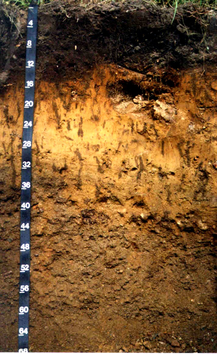
This Merrimac profile has a 15 inch fine sandy loam Ap horizon, from 15 to 20 inches is a fine sandy loam Bw1 horizon, 20 to 30 inches is a fine sandy loam Bw2 horizon (the dark vertical streaks are worm burrows), and below 30 inches is a 2C horizon consisting of stratified fluvial sand and gravel. Photo by Rob Tunstead, NRCS, Location 42 39' 02.1"N, 70 50' 57.6"W (Essex County Massachusetts).
Merrimac Pedon S08MA023002 -
Click for Pedon
Description