 USGS
Topo Location
Download Monitoring Well locations for viewing with
Google Earth
USGS
Topo Location
Download Monitoring Well locations for viewing with
Google Earth
![]()
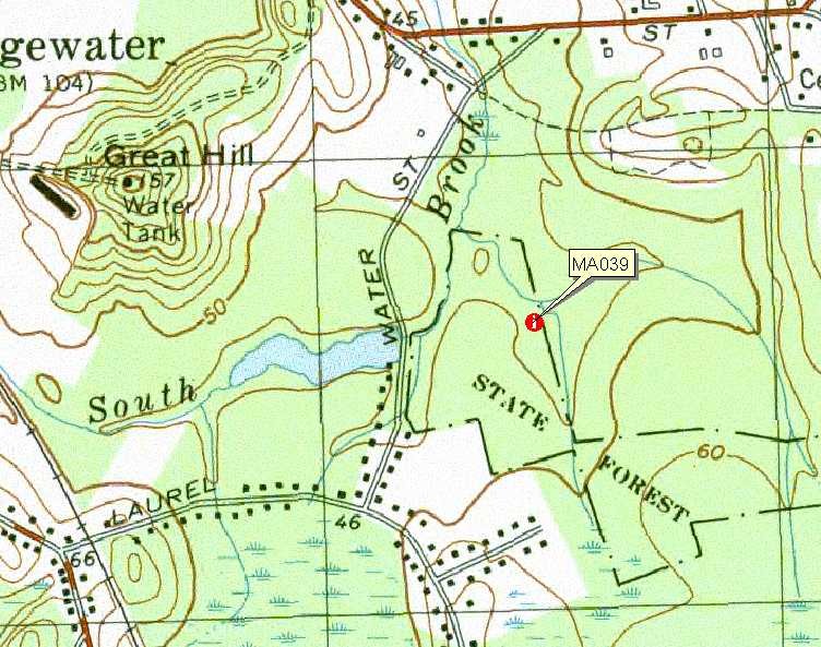
| Soil Water Table Monitoring Index well MA039 - Raynham Soil, Bridgewater, MA. |
|
LOCATION.-- 41°59'3.12"N Lat, 70°56'57.48"W Lon. Bridgewater
Quad, town of Bridgewater (State Forest), 1300' east of Water Street, 2100'
south of Rt. 104, 2300' west of Walnut Street
WELL CHARACTERISTICS.--There are 6 wells installed in a glacial lake
plain all wells were 2 inch PVC slotted pipe. These wells were installed as part
of a hydric soil study by UMASS (Adopt-A-Well).
ELEVATION.-- Surface is 30 feet above sea level, from Google Earth.
SOIL TYPE.--The network of wells are mainly in
Raynham and Scio soils, MA039.6 was in a
lodgement till soil.
GEOLOGY.-- Silty lacustrine deposits (Glacial Lake Taunton).
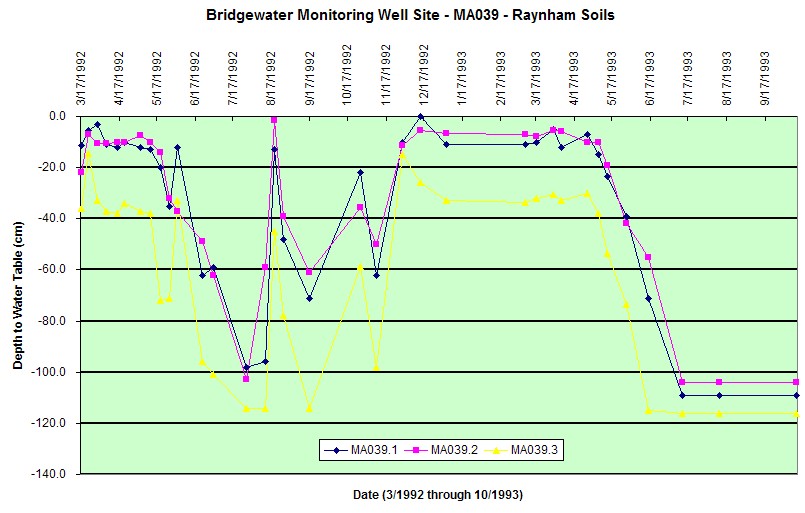
WELL OBSERVATIONS.--Below are the hydrographs for the wells MA039.1
through MA039.3
Contact Jim Turenne for more information | Return to Index Wells
Click here to view a presentation about using a
device to measure maximum water table depths (Morgan and Stolt)
USGS Water Resources of
Massachusetts and Rhode Island - Ground-Water Data
WRP Technical Note HY-IA-3.1 Installing Monitoring
Wells/Piezometers in Wetlands