Download soil profile locations for viewing with Google Earth
(500 KB KMZ file, requires Google Earth to be installed).
New England Soil Profiles
Woodbridge Series
Download soil profile locations for viewing with
Google Earth
(500 KB KMZ file, requires
Google Earth to be installed).
![]() (Link to Site)
(Link to Site)
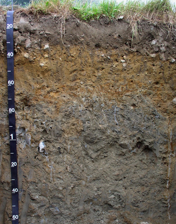
Ruler in meters
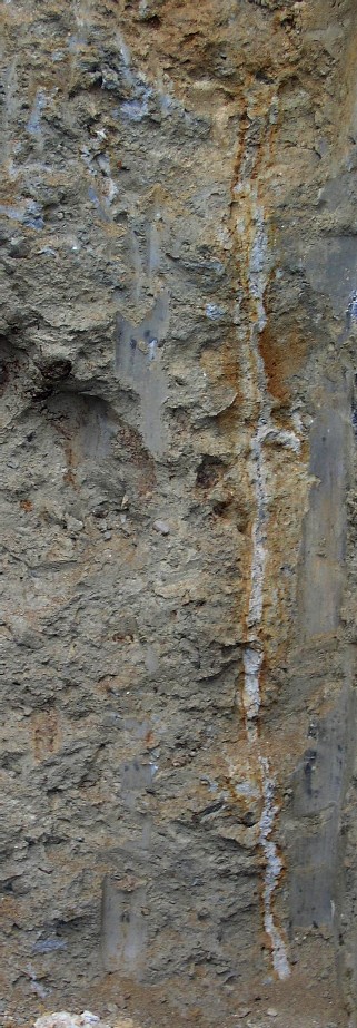
Woodbridge soils are moderately well drained soils formed in a sandy loam eolian mantle (solum of the soil), underlain by loamy lodgment till. The profile has a 10 YR 3/2 fine sandy loam Ap horizon (0 to 30 cm), a 10YR 5/6 fine sandy loam Bw horizon (30 to 70 cm), and a 2.5Y 6/3 2Cd horizon down to 160 cm. Note the vertical desiccation crack on the right - a dead root channel is in the crack which is gray (redox depletion, surrounded by a redox concentration). The estimated seasonal high water table for this soil is approximately 50 cm below the surface.
Photo by Jim Turenne. Photo Location:
Portsmouth, RI
41 degrees 38 minutes 13 seconds N, 71 degrees 14 minutes 54 seconds W
|
WOODBRIDGE SOIL PROPERTIES: Taxonomic
Classification: Coarse - loamy, mixed, mesic, Aquic
Dystrochrepts. Potential Inclusions: Scituate, Birchwood, and Newfields soils are similar inclusions. Poorly drained Norwell, Sippican, and Ridgebury soils are along drainageways. Well drained Paxton, Poquonock and Montauk soils are on convex slopes.
|
Close - up of the desiccation crack in left corner of photo
|
Back to Images
Back to Nesoil.com