 USGS
Topo Location
Download Monitoring Well locations for viewing with
Google Earth
USGS
Topo Location
Download Monitoring Well locations for viewing with
Google Earth| Soil Water Table Monitoring Index Well - Eames Way, Marshfield, MA. - Birchwood Series |
USGS
Topo Location
Download Monitoring Well locations for viewing with
Google Earth |
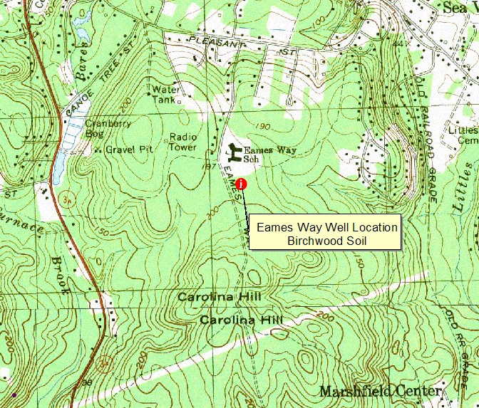
LOCATION--42 degrees, 07 minutes, 49 seconds North Latitude. 70
degrees, 43 minutes, 38 seconds West Longitude.
Plymouth County, Town of Marshfield, approximately 2,500 feet south of the
intersection of Pleasant Street and Eames Way.
WELL CHARACTERISTICS-- 2 inch slotted PVC well installed to a depth of
102 inches.
ELEVATION-- 193 feet.
SOIL TYPE.- Birchwood soils are
mapped at this site but the depth to dense till is below 102 inches. A pedon
description of the soil will be available soon.
GEOLOGY.-- Marshfield Hill deposits - complex geology consisting of
sandy moraine deposits underlain by glacially thrusted coastal plain silts and
clay.
WELL OBSERVATIONS.--Below is the hydrograph of the well, monitoring
period was from May 2005 through 2004.
Contact Jim Turenne for more information | Return to Index Wells
Click here to view a presentation about using a
device to measure maximum water table depths (Morgan and Stolt)
USGS Water Resources of
Massachusetts and Rhode Island - Ground-Water Data
WRP Technical Note HY-IA-3.1 Installing Monitoring
Wells/Piezometers in Wetlands