 USGS
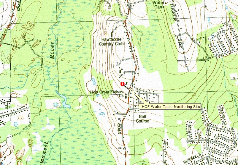
Topo Location
Download Monitoring Well locations for viewing with
Google Earth
USGS
Topo Location
Download Monitoring Well locations for viewing with
Google Earth
![]()
| Soil Water Table Index well -HCF (Dartmouth MA. - Woodbridge Soils |
|
LOCATION.--Lat 41.609778 N, Lon 70.981327
W | UTM NAD 83 Zone 19 meters: 334904.71 Easting, 4608351.88 Northing.
Bristol County Massachusetts, Town of Dartmouth.
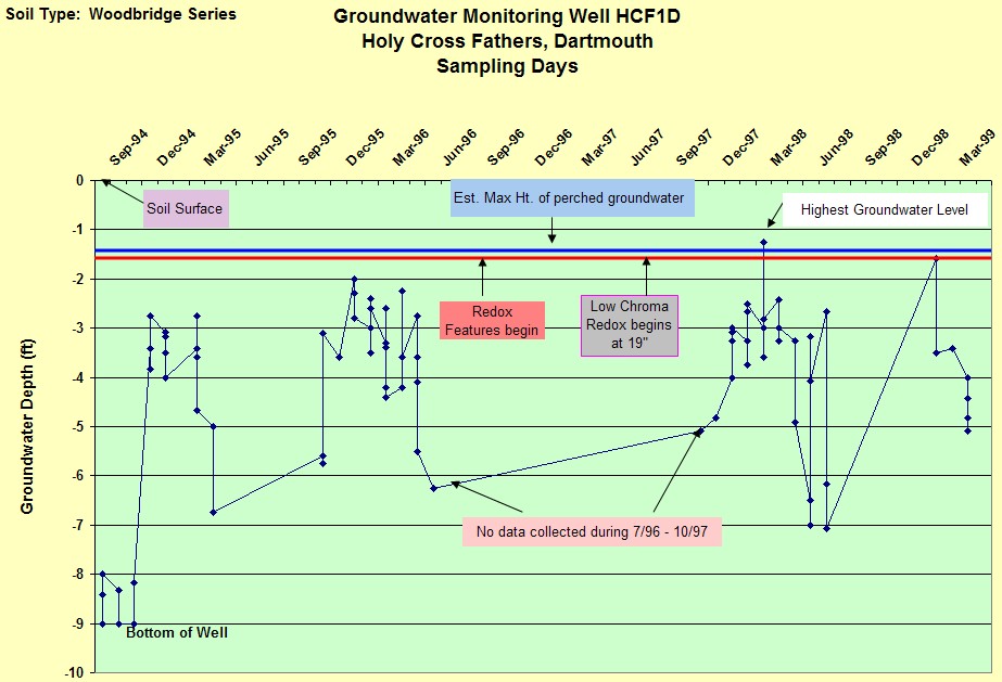
WELL CHARACTERISTICS.-- 2 inch slotted PVC pipe installed to a depth of 9
feet below the surface. Well was monitored during the following periods: 9/94 to
1/95, 3/95 to 4/95, 11/95 to 6/96, 11/97 to 7/98, 2/99 to 4/99. A total of 77
observations were made. A total of four wells were monitored at this site (a
deep and a shallow well at 2 locations).
ELEVATION.-- 120 feet (USGS Topo - National Geodetic Vertical Datum of
1929)
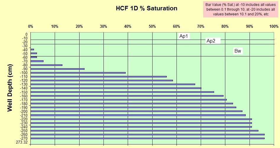
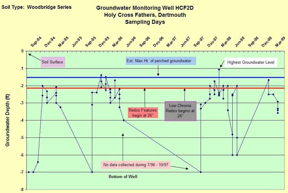
SOIL TYPE.- Woodbridge Soils
(moderately well drained). The estimated average seasonal high water table,
based on soil morphology for this site is -19 inches below the surface based on
soil morphology. Below is a description of the soil from a small hand-dug test
pit:
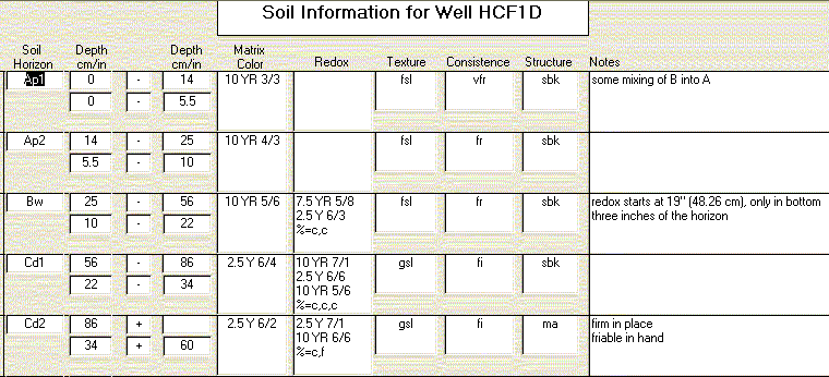
GEOLOGY--Sandy loam eolian solum underlain by lodgement
(dense) till. Landform is a south-west sloping side-slope of a drumlin.
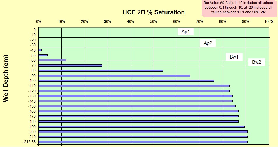
WELL OBSERVATIONS-- Below are the hydrographs of the wells.
Well HCF2D
Contact Jim Turenne for more information | Return to Index Wells
Click here to view a presentation about using a
device to measure maximum water table depths (Morgan and Stolt)
USGS Water Resources of
Massachusetts and Rhode Island - Ground-Water Data
WRP Technical Note HY-IA-3.1 Installing Monitoring
Wells/Piezometers in Wetlands