 USGS
Topo Location
Download Monitoring Well locations for viewing with
Google Earth
USGS
Topo Location
Download Monitoring Well locations for viewing with
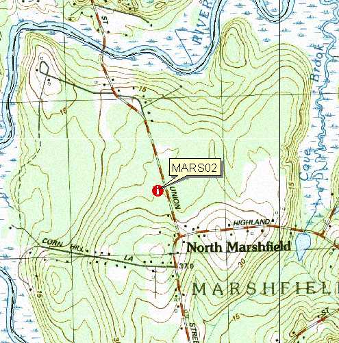
Google Earth| Soil Water Table Monitoring index well MARS02-Woodbridge Soil, Marshfield MA. |
USGS
Topo Location
Download Monitoring Well locations for viewing with
Google Earth |
LOCATION.--Lat 42o08' 49" N, Long 070o
46' 18"
W NAD 83. Massachusetts State Plane NAD 83, 260,212 Easting, 877,662 Northing.
Plymouth County, Town of Marshfield - 36 meters west of Union St., 475 meters
north of Corn Hill Lane, Marshfield Conservation Land. Location geo-referenced with a PLGR GPS.
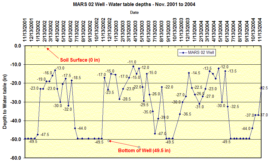
WELL CHARACTERISTICS.--Well type - 2.0 inch diameter screened PVC pipe, total well depth = 49.5 inches below the surface. Installed November 13, 2001. A piezometer was installed into the dense till with the bottom depth at 58 inches.
ELEVATION.-- Surface is 26 Meters (88 feet) above sea level, from topographic map (National Geodetic Vertical Datum of 1929).
SOIL TYPE.--Woodbridge Series - moderately well drained soil formed dense basal till. Click for a complete pedon description of the soil log from the MARS02 well. The estimated average seasonal high water table, based on soil morphology for this site is 16 inches below the surface based on soil morphology. Click here for Soil Temperature Data from this site.
GEOLOGY.-- Sandy loam eolian mantle underlain by lodgement till.
WELL OBSERVATIONS.--Highest recorded water table depth -11 inches below the surface. Table Notes: Water table depth is the measured depth to water below the ground surface. Ground surface datum for these readings is 0, to determine the actual depth to water below the surface elevation subtract the depth in the table from 88 feet. The 49.5 inch depth is the total depth of the well.
Contact Jim Turenne for more information | Return to Index Wells
Click here to view a presentation about using a
device to measure maximum water table depths (Morgan and Stolt)
USGS Water Resources of
Massachusetts and Rhode Island - Ground-Water Data
WRP Technical Note HY-IA-3.1 Installing Monitoring
Wells/Piezometers in Wetlands